
Quesnel Lake
Quesnel Lake is a glacial lake located in the Cariboo area of the Cariboo Chilcotin Coast region of British Columbia, and is the source of the Quesnel River. With a depth up to 610 metres, it is the deepest lake in British Columbia and is thought to be the deepest fjord lake in the world. It has almost 600 km (360 miles) of shoreline distributed among the three arms – West, East and North Arms. In the heart of the Cariboo Mountains, it has stunning scenery including sandy beaches and ancient cedar rainforests up the North Arm and fjord-like rock walls and our own Niagara Falls up the East Arm. It lies just to the west of three provincial parks – Bowron Lake, Cariboo Mountains and Wells Gray.
The principal interest in Quesnel Lake is its fishery. It is a popular sport fishing destination, and is also home to about a quarter of BC’s sockeye. Anthropogenic disturbance nearly wiped out the sockeye population in the early 1900s, but it has now rebounded to historic levels. The lake is a long, narrow fjord-type lake – carved by glaciers, not man-made – and is stunningly beautiful.
Cast for trophy wild rainbow trout in one of the world’s most pristine and unique settings. From diverse stillwaters to Sockeye salmon creeks and rivers, the exceptionally beautiful and unique Quesnel Lake ecosystem offers Rainbow trout angling that is unparalleled anywhere in British Columbia. Measured in pounds and not inches, many expert fly fishers say that this is hard to match anywhere on earth!

Quesnel, Gold Pan City, Cariboo | Province of BC
Location
There are two access points to Quesnel Lake.
1) To the town of Likely on the west arm of Quesnel Lake: turn east off Hwy 97 at 150 Mile House onto the Horsefly Rd. Continue to the major intersection of paved roads, then turn left (northeast) onto the Likely Road. Total distance from 150 Mile is 85 km (53 mi). From here you can access the northern portion of the lake. Ask for information and directions in Likely.
2) To the village of Horsefly and on to the southern shores at the junction of the three arms of Quesnel Lake: turn east off Hwy 97 at 150 Mile House on to the Horsefly Road. Stay on this road until you reach the village of Horsefly – 59 km (37 mi). Once in Horsefly, turn right at Clarke’s Store and cross the Horsefly River, as if going to Horsefly Lake. More directions and more information can be obtained in Horsefly.


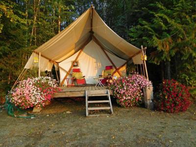
Quesnel Lake and Nearby Accommodations
British Columbia Lodging and Campgrounds Association Members
List
Map
BC Lodging & Campgrounds Association
209 - 3003 St John's Street
Port Moody, BC
Canada V3H 2C4