
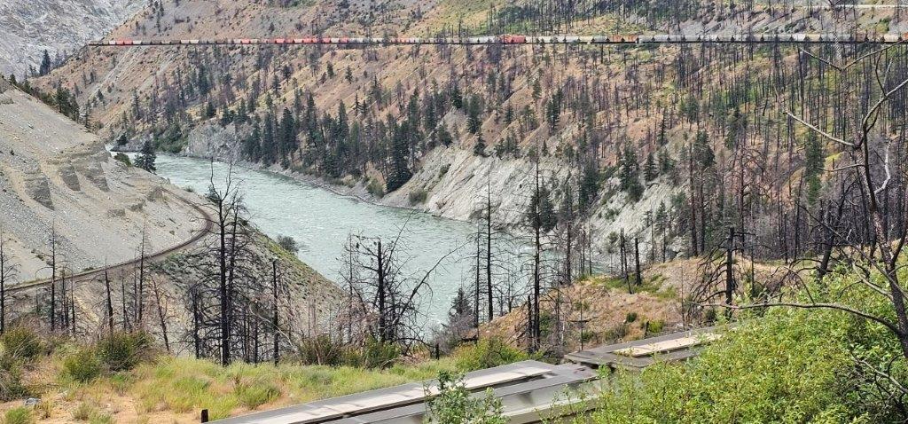
Long Freight Train in Fraser Canyon
Gold Fever: British Columbia’s World Famous Fraser Canyon
By Travel British Columbia
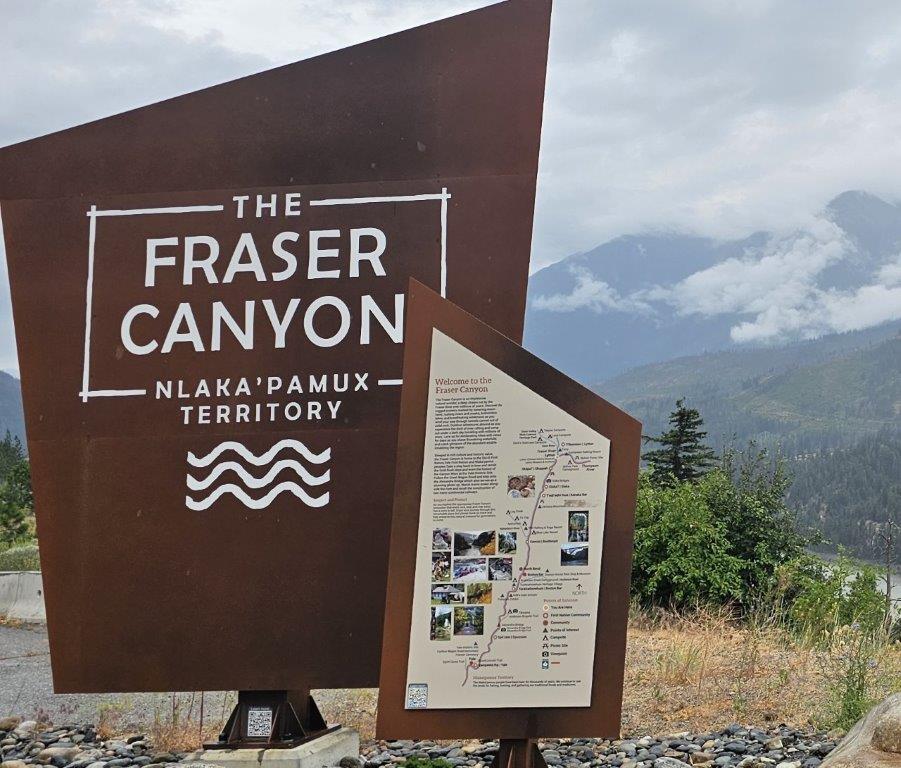
The Fraser Canyon stretches from Hope to Lytton and beyond. The Trans-Canada Highway (Hwy 1) follows the narrow Fraser River corridor through the mountains, crossing side crevasses and ravines on bridges and trestles and passing through a series of tunnels. Seven highway tunnels range from approximately 67 m to 610 m.
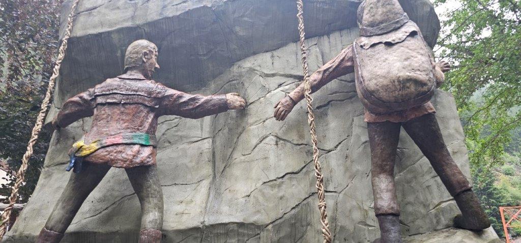
Hwy 1 is generally a means of getting from Vancouver to British Columbia’s Interior as quickly as possible, but this corridor has a lot to offer and has been designated a national historic site for much of its length through the Fraser River Canyon. Fur traders and later gold miners followed Indigenous routes while confronting almost insurmountable obstacles on their way to the gold fields. Some early travellers traversed the canyon by climbing along vertical walls on narrow shelves suspended by ropes.
As the Gold Rush developed, stagecoaches began operating after the Cariboo Wagon Road was established from Yale through Ashcroft, Clinton and onward to Barkerville.
Transportation routes changed dramatically when the Canadian Pacific Railway completed its rail line through the canyon in 1883, followed by the Canadian National Railway in 1915. The Trans-Canada Highway was completed in the 1950s, establishing the modern highway as a vital national transportation corridor.
Today, freight trains provide an impressive visual reminder of the canyon’s continuing importance. Powerful diesel locomotives haul freight trains along opposite sides of sections of the Fraser Canyon. Long strings of colourful shipping containers, tanker cars, grain trains and bright yellow potash and coal unit trains can be viewed from vantage points close to the highway. Depending on the train and its load, freight trains may stretch for more than 100 cars and extend well over a kilometre.
Hope
Hope lies at the southern gateway to the Fraser Canyon, where the Trans-Canada Highway 1, Coquihalla Highway 5 and Crowsnest Highway 3 converge. The town is a hub for travellers heading into the Interior and is the self-proclaimed Chainsaw Carving Capital of Canada. A self-guided walking tour leads to more than 70 chainsaw carvings throughout town, including the witch-like Cannibal Woman and Bart the Bear.

The adjacent Japanese Friendship Garden commemorates the 2,800 Japanese Canadians who were interned in Sunshine Valley during the Second World War. Christ Church National Historic Site illustrates an Anglican church in Gothic Revival style, consecrated at the beginning of the Fraser Canyon Gold Rush in 1861.
Hope was also known as Hollywood North when Rambo: First Blood was filmed here, with extensive use of pyrotechnics to blow up the gas station, hydro substation and Outpost Gun Shop. A self-guided walking tour leads to a dozen filming locations used more than 40 years ago. John Rambo, played by Sylvester Stallone, continues to draw movie buffs to this mountain town.
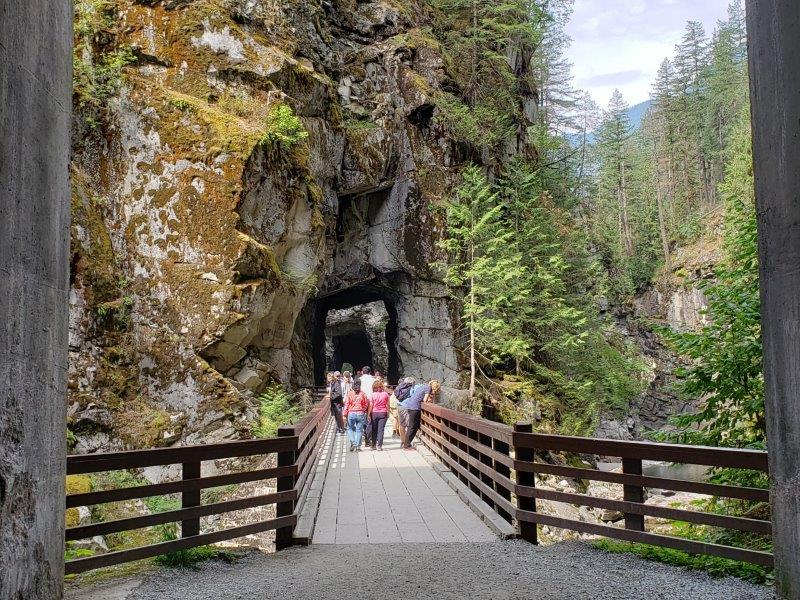
Othello Tunnels
Forming part of the original Kettle Valley Railway, Othello Tunnels lies to the north of Hope, built through metamorphic rock during a period of intense railway expansion. The 100-year-old series of four tunnels is connected by trestles and forms part of the KVR Rail Trail in Coquihalla Canyon Provincial Park.
Yale
About 24 km north of Hope is Yale, a former gold-rush settlement established in 1848 at the head of river navigation. A marker commemorates Simon Fraser’s journey down the river in 1808. During the Gold Rush, Yale gained a reputation for lawlessness and became the starting point of the Cariboo Wagon Road when the Fraser River became too treacherous for sternwheelers.
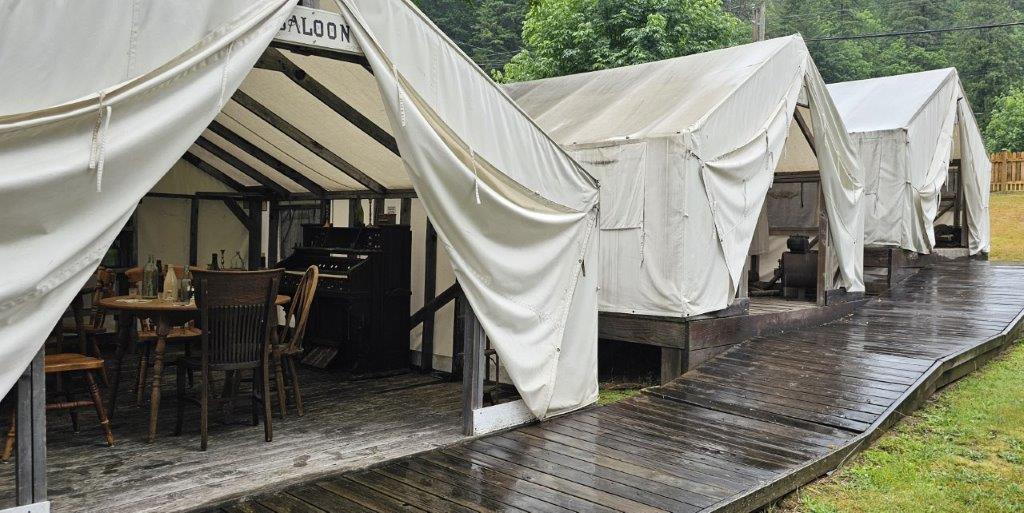
Historic sites include St. John the Divine Church, built by Royal Engineers in 1859, and the restored Creighton House, now the village museum. The church contains a display of liturgical linens used by the clergy. A national monument recognizes the Chinese construction workers who helped build British Columbia’s early transportation infrastructure, while Lee’s store and garden provide further recognition of the Chinese community.
Alexandra Bridge Provincial Park
Some 20 km north of Yale, Alexandra Bridge Provincial Park preserves a relic of the early automobile era. The original bridge dates from the 1920s and has been preserved as a provincial historic site. A dramatic 80 m cable-stay bridge deck, now used as a pedestrian walkway, spans a narrow gorge above the Fraser River, which lies about 27 m below. The bridge is reached by a 10-minute walk from interpretive panels describing the history of the former toll crossing.
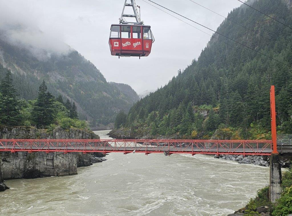
Hell’s Gate Canyon
Heading northwards you will come to Hell’s Gate, one of the most dramatic sections of the Fraser Canyon. An Airtram crosses the canyon, suspended 240 m above the lower terminal. Below, the equivalent of approximately 3,500 basketballs of water per second roars through a 35 m-wide gorge between vertical granite walls.
A series of fishways enables migrating salmon to fight their way upstream against currents reaching approximately 40 km per hour. Fishery exhibits explain the salmon life cycle and the ocean migration patterns of all five species of Pacific salmon.
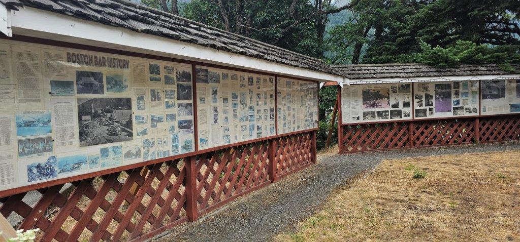
Boston Bar and North Bend
About 42 km north of Hell’s Gate are Boston Bar and North Bend, communities on opposite sides of the Fraser River. Interpretive signs beside an aerial ferry displayed in Francis Harrington Park explain the history of the ferry that once connected the two communities before the Cog Harrington Bridge was built.
Tuckkwiowhum Village
A short distance north of Boston Bar, Tuckkwiowhum Village offers guided tours at this First Nations heritage site. Visitors can explore a smokehouse, food cache, sweat lodge and pit house.
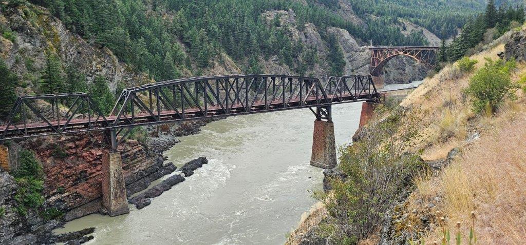
Lytton
Lytton lies 44 km north of Boston Bar and is located at the confluence of the Thompson and Fraser Rivers. The village was devastated by a raging wildfire in 2021 and continues to be rebuilt with strong community support. The Lytton Chinese History Museum has reopened following the replacement of many artifacts lost in the fire.
Lytton, on the Thompson River, is known as the Whitewater Rafting Capital of Canada and is associated with such notorious stretches of river as Devil’s Gorge and the Jaws of Death.
The Fraser River between Hope and Lytton offers some of the most dramatic landscape and treacherous sections along the route. The river has carved deep, narrow gorges through vertical canyon walls as it descends from the Interior. From viewpoints high above, the river can appear deceptively tranquil; close to the water, however, powerful whirlpools and rapids reveal its true character.
The Fraser Canyon is more than a spectacular landscape. It is a transportation corridor shaped over centuries by Indigenous travel routes, the Gold Rush, railways and highways. From Hope’s gateway to the Interior to the upper canyon near Soda Creek, the Fraser River has dictated where people could travel—and continues to shape how British Columbia is connected from the coast to the Interior Plateau.
TIP: If you find this blog interesting why not subscribe to the enewsletter and never miss another story!
Read more about the Gold Rush Trail in Following the BC Gold Rush Trail through the Cariboo & Beyond
For accommodations in British Columbia check out travel-british-columbia.com
Share your BC travel photos using hashtag #travelinbc
Published: October 8, 2026
Last Updated: October 8, 2026

Categories
- Accommodation
- Activity
- Beachcombing
- Biking
- Breweries & Cideries
- Campfire Activity
- Chair Lift or Gondola
- Childrens Activity
- Dancing or Music
- Dining
- Drives and Circle Tours
- Eating
- Farm Animals
- Farmers Markets
- Ferry Ride
- Festival
- Film Buffing
- Fishing
- Flying
- Four by Fouring
- Gold Panning
- Golfing
- Hiking
- Hockey
- Horse Racing
- Hot Springs
- Kayaking
- Motorcycle Camping
- Music
- Paddleboarding
- Plants & Berries
- Rafting
- Running or Walking
- Shopping & Gifts
- Skating
- Skiing
- Snowshoeing
- Star Gazing
- Storm Watching
- Sweets and Candy
- Swimming
- Watersports
- Wildlife Viewing
- Wine Tours
- Ziplining & Adventure Parks
- Attraction
- British Columbia
Popular Posts
- Salmon Spawning in the Fraser Valley, British Columbia – A Fun Day for the Family
- Best Places to See the Northern Lights in British Columbia, Canada
- Relax, Refresh & Rest Up Along the Sea to Sky Highway
- 5 Awesome Suspension Bridges Near Vancouver, British Columbia, Canada
- Daytripping in Campbell Valley Park, Langley, British Columbia
BC Lodging & Campgrounds Association
209 - 3003 St John's Street
Port Moody, BC
Canada V3H 2C4