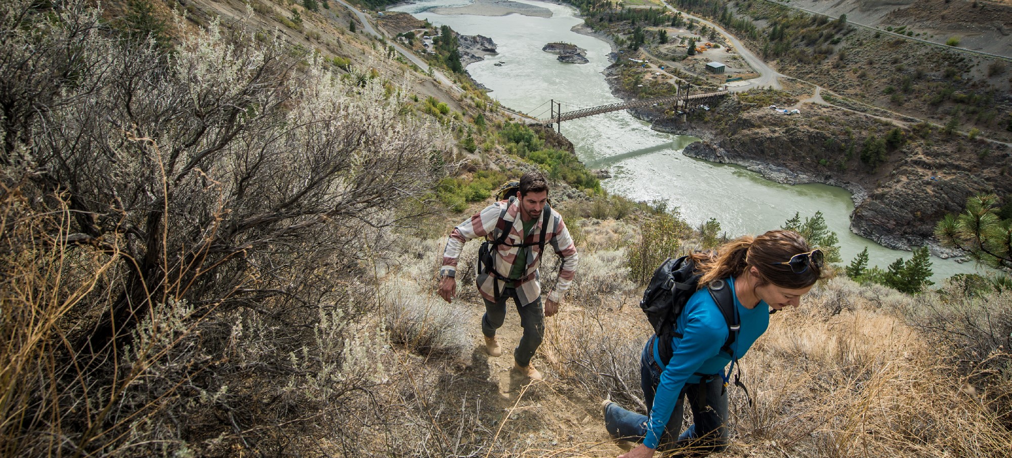
Hiking along the Fraser River, Lillooet, Photo Destination BC Blake Jorgenson
BC’s Coast Mountain Circle Tour – Mountains, Forests & Canyons
By Patricia Cashin
British Columbia can be explored year-round, providing you have the proper winter tires during snow season of course, so circle tours are worth considering no matter the time of year. One such tour is the Coast Mountain Circle Tour. This tour explores the mountains, forests, and canyons that make British Columbia a world-renowned place of wilderness beauty. The tour winds through misty coastal mountains and into the province’s rain shadow and dry highland plateau. It takes you through historic Gold Rush Country, following the path of the gold seekers down the Thompson and the raging Fraser Rivers. Note: some of the activities mentioned may not be available during the winter – check before you go.
Here is a sampler of the trip. More details can be found by going to Coast Mountain Circle Tour.
Vancouver to Pemberton
The tour commences in Vancouver taking the Sea to Sky Hwy 99 north through Whistler and then to Pemberton. Climbing up from the Pacific Ocean and high into the Coast Mountain wilderness the road winds around spectacular fjords and sheer rock faces that rise up from the sea. The journey along Howe Sound offers vistas from highway pull outs and places to take memorable photos.
At Britannia Beach you can tour the award winning National Historic Britannia Mine Museum and take a train ride though the mine to experience the ingenuity of geologists of the early 1900s. Further along the Sea to Sky Highway is Shannon Falls – Canada’s third largest waterfall. Squamish is a winter activity destination and popular in the summer with kiteboarders and rock climbers.
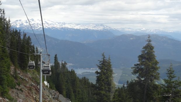
Climbing through the Coastal Mountains you come to the resort town of Whistler, the internationally famous year-round destination and snow-sport mecca. Along the way is Alice Lake Provincial Park where canoeing, kayaking, bird watching, and picnicking are available and stop at Brackendale, home to thousands of bald eagles between November and April. North of Whistler is Pemberton home of ranching, farming and hidden hot springs.

Pemberton to Lillooet
Hwy 99 (also known as the Duffy Lake Road) turns inland at Pemberton and winds through the spectacular Coast Mountain peaks. You will leave the wet coastal forests and abruptly enter the rain shadow of British Columbia’s interior. Hardy pine trees and sagebrush replace the towering fir trees and green foliage of the west coast.

The town of Lillooet dates back to the Cariboo Gold Rush. Lillooet was mile 0, the start of the old Cariboo Waggon Trail that joined with the Gold Rush Trail south at Lytton. The sights are reminiscent of the frontier days – the Hangman’s Tree, Old Newspaper office, and Chinese Rock Tailings are a throwback to a time long before the Duffy Lake Road was open to tourists. At Lillooet you can either continue north on Hwy 99 or turn south along Hwy 12 towards Lytton.
Lillooet to Lytton
Hwy 12 takes you into an arid high mountain region where the Coastal Mountain range meets a semi arid desert created by the rain shadow of the mountains. If you choose to head northeast on Hwy 99 from Lillooet, the road twists through the cliffs of the Fraser River Benchlands. After ages of erosion the Fraser has cut deep into the canyon leaving these benches high above the river. With irrigation, the shelves easily became lush green fields – a stunning contrast to the yellow-brown canyon walls.
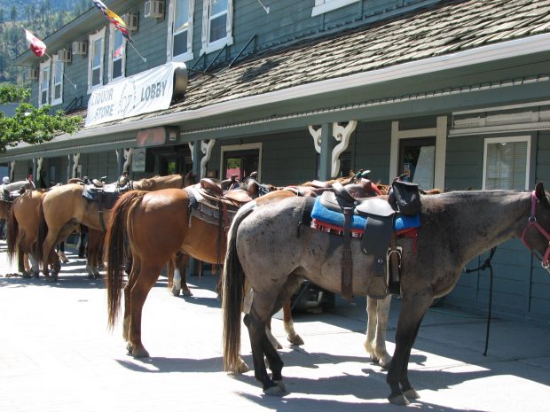
At the junction of Hwy 99 and 97 is Historic Hat Creek Ranch where you can get a taste of early pioneering life. From here turn south towards Cache Creek known for its ‘wild west’ ambience. Follow Hwy 1 and the Thompson River south and stop where the Canadian Northern Pacific Railway hammered in its last spike. Heading south the canyons grow steeper and narrower. At the town of Lytton, the Thompson and Fraser Rivers meet at a spectacular confluence. For a close-up look, adventure guides offer river rafting trips during the summer.

Lytton to Vancouver
Hwy 1 is carved into the cliffs of the Fraser Canyon following the river as it rushes between the rocky walls and past Hell’s Gate, the narrowest point on the whole Fraser. Hell’s Gate Airtram descends into the gorge and brings visitors close to the raging white water torrent. At Yale, the canyon opens up and the Fraser River spills out into the Fraser Valley and the raging white water becomes a slow, meandering waterway. The Yale Museum provides the background on the significance of this location as the start of the Gold Rush Trail (check for open information).

Further on is Hope which is located at the foot of the Cascade Mountains and known as the Chainsaw Carving Capital. Following the route along Hwy 7 north of the Fraser River is a very scenic drive and provides a chance to take a short 8 km jog to the resort village of Harrison Hot Springs with sandy beaches and a string of inspiring mountains that cradle a majestic 60 km stretch of lake.
If you take the Hwy 1 route to Vancouver from Hope you pass by Bridal Falls Provincial Park with its unique 122 m (400 ft) waterfall. Close to Vancouver is Fort Langley National Historic Site that showcases what British Columbia life was like in the early 1800s.
As you continue along Hwy 1, you will return to Vancouver, completing the Coast Mountain Circle Tour.
TIP: If you find this blog interesting why not subscribe to the enewsletter and never miss another story!
For a map, directions and more information go to Coast Mountain Circle Tour.
For accommodations in British Columbia go to travel-british-columbia.com
Share your BC travel photos using hashtag #travelinbc.
Published: October 28, 2020
Last Updated: December 7, 2023

Categories
- Accommodation
- Activity
- Beachcombing
- Biking
- Breweries & Cideries
- Campfire Activity
- Chair Lift or Gondola
- Childrens Activity
- Dancing or Music
- Dining
- Drives and Circle Tours
- Eating
- Farm Animals
- Farmers Markets
- Ferry Ride
- Festival
- Film Buffing
- Fishing
- Flying
- Four by Fouring
- Gold Panning
- Golfing
- Hiking
- Hockey
- Horse Racing
- Hot Springs
- Kayaking
- Motorcycle Camping
- Music
- Paddleboarding
- Plants & Berries
- Rafting
- Running or Walking
- Shopping & Gifts
- Skating
- Skiing
- Snowshoeing
- Star Gazing
- Storm Watching
- Sweets and Candy
- Swimming
- Watersports
- Wildlife Viewing
- Wine Tours
- Ziplining & Adventure Parks
- Attraction
- British Columbia
Popular Posts
- 5 Awesome Suspension Bridges Near Vancouver, British Columbia, Canada
- Places in British Columbia where Bigfoot Hangs Out
- Best Places to See the Northern Lights in British Columbia, Canada
- Hiking Meares Island, Tofino, British Columbia
- 9 Late Summer & Fall Picnic Spots in Vancouver, Coast & Mountains, British Columbia
BC Lodging & Campgrounds Association
209 - 3003 St John's Street
Port Moody, BC
Canada V3H 2C4